
Approved for Nomination to the National Register:
Lindquist Building, Lindsborg

Peter J. Lindquist was born in Skoda, Sweden in 1872. He purchased the lot and built this building in 1901 after immigrating to the U.S. in 1892. He married Lindsborg native Anna Swenson in 1895. The Census and Sanborn maps show the Lindquists living in the second-floor apartment possibly due to financial hardships during the Depression.
Although built for Lindquist's tailor business, the commercial space was rented out for most of the Lindquist's ownership of the building. Anna Lindquist sold the building in 1946 six years after her husband died.
The best known business that occupied the Lindquist Building was The Tea Cup Inn, owned and operated by Mary Linderholm who moved to town and opened up the Inn after her husband died in 1912. Her daughters worked as the waitresses. Mary closed the Inn in 1922 due to her daughters growing up and living their own lives. Since then, a variety of businesses have occupied the ground floor until 2006 when the building became vacant. It was purchased by its current owner in 2013. For more information, go here.
Washington School, Independence

The interior features 14 classrooms, two for each grade, a Kindergarten room, art and music room, kitchen, lunch room, and assembly room with a stage. Washington School was built quickly as, since it was a WPA project, ground had to be broken by the end of the year (1938) and completed within one year. In 1991, Washington became the school that housed the fifth graders until 2011 when Jefferson Elementary School was built to house 3rd-5th graders. Washington's sister school, built at the same time, Lincoln Elementary was sold to the hospital and demolished while Washington was recently sold and will be converted into apartments. For more information, go here.
Bown-Corby School, Marion

Bown-Corby held classes for grades Kindergarten through 8th until 1961 when a new modern elementary school was built. Bown-Corby then held Kindergarten through 3rd grade until 1992 when it became the Marion County Community College until 2012. It was recently purchased by a developer who plans to renovate it into apartments. For more information, go here.
Hermit Cave and Belfry Hill, Council Grove


Belfry Hill is a natural rise of about 70-100 feet near the center of Council Grove. Early photos shows a bare mound with no trees or vegetation. By the 20th Century, the hill was covered with mature trees creating a beautiful backdrop to downtown Council Grove. Terracing was placed around the hill in 1901 in an effort to clean up the hill. Since then, the area has been a popular tourist attraction.
Hermit's Cave is located on the eastern bluff of Belfry Hill. A stone staircase leads from Belfry Street to the cave. For five months in 1863, Father Giovanni de Agostini (Father Francesco) stayed in the cave while traveling the Santa Fe Trail. He became known as the Hermit Priest thus giving the cave its name.
Another feature of Belfry Hill is the Old Bell Monument. Nearly nine feet tall, a limestone obelisk hold the remains of a bell placed there in 1863 that was used to warn the townspeople of Indian raids, however, this is inaccurate. The bell broke in 1884 but was rescued and attached to this stone monument in 1901 after a group of schoolchildren raised money and stone for the memorial. Initials of the schoolchildren are carved into the stone. The bell was purchased from the Plymouth Congregational Church in Lawrence in 1863 after it was rejected for having a crack. The bell was used until 1884, even tolling all day when President James Garfield died in 1881, when a wind storm destroyed the bell tower and the bell rolled down the hill and was further damaged by vandals. The bell was used as a flower pot until 1901 when the monument was constructed.
For more information, go here.
Fix Farmstead, Alma

John built a sturdy stone house shortly after arriving on land just west of his parents original claim. In 1886, the Fixes sold a strip of land to the Chicago, Rock Island and Pacific Railroad. After the railroad was built a town, Volland, was established nearby. John Fix died in 1918, Rebecca following in 1922. The farmstead stayed in the family until 1955 when it was sold. John Fix, along with his wife, daughter, parents and close friends are buried near the farmstead in the Fix Cemetery along the railroad.
For more information, go here.
The Parsonian Building, Parsons

For more information, go here.
Route 66 Historic District, Baxter Springs

The nominated portion spans 2.1 miles from just south of the Brush Creek Rainbow Arch Bridge (1923, on the NRHP) to the Willow Creek Bridge. For more information, go here.
St. Mary's Church, Kinsley
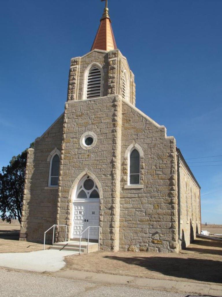
St. Mary's closed in 1997 due to a lack of priests but it remains well-taken care of and the nearby cemetery is still used and owned by the Wichita Archdiocese. The church is owned separately. At the time of its closing, around 30 families were still involved with the church. For more information, go here.
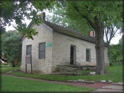
Girl Scout House, Ashland

For more information, go here.
Strother Field Tetrahedron Wind Indicator, Winfield

Since the airfield didn't have a control tower to assist the pilots, giant tetrahedron wind indicators were installed so that pilots could see which direction the wind was blowing from the air. The tetrahedron were made of thin metal and canvas. The Strother Field wind indicator even retains its original lighting which was used by pilots at night so they could tell the direction. For more information, go here.
It was also decided to add The Last Chance Store in Council Grove to the State Register of Historic Places. It was built in 1857 and was the last stop to buy supplies along the Santa Fe Trail for many years.
Information and photographs courtesy of the Kansas State Historical Society.