Showing posts with label Wabaunsee County. Show all posts

Saturday, January 17, 2026

Topeka, Eskridge & Council Grove Railroad

Proposed routes for the Topeka, Eskridge
& Council Grove Railroad. You can view
an interactive map here.
In 1903, it was proposed to create a railroad line from Topeka, following the Mission Creek Valley, through Eskridge, and on to Council Grove. It was to be known as the Topeka, Eskridge & Council Grove Railroad. As with such projects, some people were for it and others against it. Dover and Auburn fought over which city the railroad should go through, Eskridge worried the railroad would harm their businesses, and Council Grove was excited to have a railroad connection to Kansas towns east.

Osage Free Press, Dec. 16, 1903

Ranchers in Wabaunsee County were excited to use the new railroad to haul their cattle to Kansas City and smaller towns, like Halifax, were excited for a possible population boost. Plans were made to expand the railroad to Emporia (as seen above) but also to Burlington, Tonganoxie, and Brown County(!). But that wasn't all. Proposals for the track to be used to bus Washburn University students to and from their nearby hometowns were made. They tried to even hype up the Rock Island and Santa Fe railroads that having a railroad running directly between their lines would help them. The extensions to Burlington and Pierce Junction were specifically to attract attention of the Santa Fe and Missouri Pacific railroads.

Despite being told in 1905 that there was not enough population to warrant a railroad, Topeka and Council Grove continued to push it. In 1906, now renamed the Topeka & Southwestern Railroad, officers were elected to plan a route and secure money for the railroad. The routes they chose, expanding the plan to two lines were selected in late 1906. The estimated locations are in the map above. Work started in November 1907 with a dirt moving ceremony on Washburn university campus. This gesture was apparently just ceremonial.

W.L. Taylor, of Taylor Grain Co. who was the president of
the Topeka & Southwestern. The vice president was Charles King
Holliday, son of Topeka and Santa Fe Railroad founder, Cyrus Holliday.

The right-of-way was extended in 1909 for another year and some grading was done in Morris and Dickinson counties and in Topeka but little work moved beyond that. In 1912, some of the grading in Morris and Dickinson was purchased by another railroad. In 1913, C.A. Magee urged Topeka to commit bonds to building the railroad from Topeka to Dover, hoping to spur development. They refused and finally the Topeka & Southwestern died.

The Arkansas City Daily News of April 18, 1914 reports "Southwest of Topeka there is a railroad grade of the Topeka & Southwestern and near Council Grove there is some more grade for the same line. In several places in Kansas may be found the grades of railroads of great promises but which were never built."

The grand plans for the Topeka & Southwestern Railroad. Though not mentioned in any article, it
was apparently planned to extend the Council Grove line to Marion, Kansas and have a line running
south out of Topeka to Garnett.

Saturday, December 06, 2025

Missouri John

On Wednesday night, May 4, 1898, John Thomas hired a horse and rode over to the West Fowler Ranch near Maple Hill in Wabaunse County, Kansas, where he had been employed up to a couple days ago. Thomas had rode to the ranch to see Nellie Brand, with whom Thomas had been sweet on. Supposedly, the other ranch employees, mostly Swedes, joked and insulted Thomas about the affair, the bookkeeper, also a Swede, also vying for the affections of Miss Brand. Thomas, now in a rage, swore he would kill every Swede on the ranch.

Getting into an argument, Edwin Fransen and other ranch employees urged Thomas to leave. When he finally agreed, he opened fire hitting Carl Kinstrom, Nellie Brand, missing the bookkeeper, but fatally wounding Fransen. Thomas then did leave and rode five miles to the East Fowler Ranch where he opened fire again on Gus Carlson, a man named Anderson, and, had he been there like planned, Tom Gristy.

John Thomas then rode, nonchalantly, to Halifax (a small rail town now called Hessdale located at present-day Hessdale and Halifax roads) where he stayed the night and had breakfast with J.B. Crumb. The sheriff was heading east along the railroad so Thomas went west to Alta Vista, meeting and staying with numerous people who had no idea he was wanted for murder.

John Thomas then passed through Volland, Alta Vista, and Dwight before arriving in White City. He then went to Latimer, Herington and them Templin. His last known whereabouts were at Lamb's place on May 17th--a whole 13 days after the shooting in Maple Hill. J.M. Wilkerson, an ex-police chief for the Topeka Police spent weeks searching for John Thomas, also called Missouri John because he had originally come to Kansas from Missouri. Wilkerson suggested that John Thomas was probably an alias and he was, by now, going by another different name.

In June 1898, Topeka Chief of Police Henry Steele went to Missouri on a credible tip that John Thomas was back in Missouri. The man ended up not matching the description. Wilkerson continued to search for Thomas in the western part of the state, but ultimately, John "Missouri John" Thomas was never found.

from the March 4, 1898 edition of the Alma Enterprise


Saturday, November 01, 2025

M.W. Janes

M.W. Janes was born July 22, 1841 in Crawford County, Pennsylvania but spent most of his early life in Erie, Pennsylvania. He entered Alleghany College at 14 and graduated with a math degree. He served as a bookkeeper until 1861 when he was drafted into the Civil War. He was mustered out in 1863 and left for the oil fields. Around 1870, he came to Kansas and after a few years living in Topeka, settled on 1,400 acres overlooking the Kansas River in Wabaunsee County between Maple Hill and Willard. While some of Janes' land was used for farming, most of it was a ranch for raising Hereford cattle and horses, which he was proud to show off at local fairs. In February 1872, Janes and some neighbors established a ferry. It lasted about a year. In January 1877, he established the Rocky Ford post office with him as postmaster. It closed in April 1878.

Eliza Clark was from Mankato, Minnesota. They had three children. Around 1902, Eliza underwent surgery for cancer but unfortunately never recovered. She became an invalid and passed away January 22, 1905 of erysipelas, a skin infection. M.W. passed away in the early morning hours of May 27, 1907 after a lamp on his desk exploded.

The Janes Ranch was sold about two years later and today, much of the ranch is Miller Farms. Janes' massive house overlooking the river, no longer stands but the current house was built around 1942 and the large Janes barn remains.


Information and pictures of Mr. Janes, the house, and barn, from Early History of Wabaunsee County, Kansas, 1907.

Saturday, August 09, 2025

Jaketown


Jaketown Road is one of the last reminders of a neighborhood that existed from about the 1870s until 1920s in central Wabaunsee County, Kansas. Jaketown Road is three miles of gravel road from Skyline Road to the west to Snokomo Road to the east. Also called Snokomo (or Lower Snokomo) and Pleasant Valley, Jaketown was specifically a small cluster of about eight families to the south of the Snokomo area situated where Newbury, Mill Creek, and Mission Creek townships come together. Based on maps and some county biographies, the prominent families in the Jaketown neighborhood were Weekes, Woody, Connell, Iott, and Mix.

It's unknown where the moniker 'Jaketown' came from. A post office existed in the area about a quarter mile south of Snokomo School named Snokomo from 1875 to 1881 and then again from 1886 until 1901. The postmasters were George Kneeland and Jasper Dallas. Schools in the area were Snokomo School which started in a log cabin in 1869. A stone building was constructed in 1883 and still stands today on the National Register of Historic Places. Lower Snokomo School was constructed in 1890 and still stands, though abandoned, along Skyline Road near Boothill Road. The third school was Union Center, a wood frame building, was at the southwest corner of Skyline and Dawsen Hill roads but burned down in 1990.
Snokomo School, District 24
Photo from author.

Lower Snokomo School, District 32
Photo from Wabaunsee County Historical Society

Union Center School, District 35
Photo from Wabaunsee County Historical Society
There was one church in the area, located in the southwest corner of E. Stephens property at the corner of what is now Jaketown and Bobcat roads. The Olive Hill Methodist Church was completed in 1884. Sadly, it burned down in 1891 and was never rebuilt. Typically, church services were held in schoolhouses or the Woodman Lodge.

The Woodman Lodge was built just north of the Snokomo School in about 1890. It held many events including the annual Woodman Picnic and Royal Neighbor Picnic. Events at the Lodge and the school also spilled over into Stratton's Grove across the road. The Lodge became a hay barn for Elmer Woody and was then moved to Paxico where it is now Mill Creek Antiques.
Woodman Hall
Photo from the Kansas Resources Historical Inventory (KHRI)

Most of the families mentioned above are buried in the surrounding cemeteries. Mission View and Bethlehem, which was also known as Jaketown Cemetery in local newspapers. There are also a couple of family cemeteries nearby, one for the Kuenzli family and another for the Iott family. One nondescript grave in Bethlehem Cemetery is for John Anderson Woody, who was killed in 1909 by Rufus "Rufe" King in Maple Hill.

Never much more than a small farming and ranching community, Snokomo/Jaketown/Pleasant Valley/possibly Spring Creek according to one account remains a small farming and ranching community near the center of Wabaunsee County.
View of Jaketown Road looking west from Snokomo Road. Photo from author.


An odd mention of Jaketown in a 1904 edition of the Alma Enterprise announcing a new store.


Saturday, March 10, 2018

Cemetery Saturday: Wilmington Cemetery

Wilmington, in southeastern Wabaunsee County, was founded in 1857 along the Santa Fe Trail. With a booming population and lots of businesses, Wilmington was projected to be a thriving community. In 1880, the railroad chose to go through the county four miles north of Wilmington causing many people and businesses to move there to the new town of Harveyville. Little remains of Wilmington today. The stone school and church, both built in 1870, and a couple of houses. The cemetery can be seen from the school on a small rise a quarter mile away.

Today, the schoolhouse site is a Boy Scouts of America camp site and is listed on the Kansas State Register of Historic Places. The school was consolidated in 1951.


In memory of
EMELY
Wife of
D.A. PRATT
BORN
July 23, 1856
DIED
Sep. 21, 1879
Aged
23y's 1mo.

JULIE E.P.
WIFE OF
E.H. MCMILLEN
MAY 6, 1842
FEB. 27, 1900

LILLIE
1877

E. HARRISON
1840 - 1929

THOMAS LEE BALDWIN
MAR. 17, 1878 - JULY 31, 1915

ANNIE L. BALDWIN
DEC. 10, 1881 - OCT. 15, 1960

ESTHER R. CHRIST
MAY 10, 1907
FEB. 8, 1909

OSCAR KING

JAN. 23, 1900
APRIL 16, 1922

SELINA MOWELL

1835 - 1918

Wednesday, May 11, 2016

1: Taking Shelter

Back in January and February, there was an event at the Volland Store southwest of Alma that was of photographs that Tom Parish took of arched cellars in the Flint Hills. He spent several years documenting over 300 man-made caves around the Flint Hills from the Nebraska border through Morris County and photographing over 55 of them in beautiful 360 degree images. The cellars/caves/shelters were used for cold storage, storm shelters, short-term dwellings, and many other things. When I first read about the project in the Kansas City Star, I found it fascinating and wandered through Parish’s website, clicking on the little triangles where he had found cellars. On two Saturdays in February, the Volland Store offered cellar tours which I was unable to go on because of previous plans and lack of money. Then they offered another couple of tours in April which I was able to do. The tour also gave me a reason to wander Alma and return to the ghost town of Volland which I hadn’t been to since 2009. It was amazing to see how the old brick Kratzer Store transformed into the Volland Store, an modern art gallery, gathering place, and guest room. It was inspiring to see the center of a community no longer around still serving the communities that are.

The fairly large group of us boarded a school bus and headed off back to Alma where we stopped at Palenske Hall, a building that used to be a saloon and then a bank. It is currently used for the Wabaunsee County Economic Development and Emergency Management. The cellar was probably used to house alcohol. Palenske Hall was built in 1873 and rebuilt in 1890 after a fire. Since this cellar was actually used for storage for a business, it was one of the larger we were in with a height of eight feet.


After Palenske Hall, we headed south out of Alma on K-99 toward Lake Wabaunsee. A couple miles west, we pulled into an almost abandoned property--a house had been torn down years ago and only steps to it remained. There were two caves on this property, one was 7 feet in height but was filled with water so inaccessible for exploration. The other cellar had two chambers, both 5 ½ feet tall and built into the banks of a creek.
The smaller cellar with water.

The bigger cellar outer arch. Note hanging stones in doorway to second cellar.

Inside the second cellar chamber.

Steps to the house that was demolished years ago.
We headed back to Alma but turned onto Low Water South Road toward Hessdale Road. We saw two cellars in the vicinity of a place called Thoesville, a small community that apparently vyed for county seat against Alma. I can’t find any information on Thoesville except on old maps showing the abundance of Thoes in the area. The “town” supposedly had a post office which is not listed on the Kansas Historical Society’s post office list but small post offices serving only a few residences are abundant in Kansas. We only got to see the exterior of these two Thoesville cellars. The first was built behind the post office, the second was constructed on top of what is called Lookout Hill and was said to be a hideout for bootleggers and bandits. Wild Bill Hickok is said to have used the cellar at one point.
The cellar built behind the Thoesville post office.

The cellar on Lookout Hill.

We continued along Hessdale Road to the Elmer and Evelyn Zeckser property just past Alma City Lake. Elmer and Evelyn were married in the 1930s, Elmer’s father, Frederick, moved his family into a beautiful stone house around the turn of the century. The stone house was considered the most beautiful stone house in the county and built in the 1880s or 1890s. In the 1940s, a wood frame house was built to the north of the stone house. The stone house was rented out for the next several years until it became abandoned. Due to cracking in the walls, the Zecksers, for reasons unknown to Evelyn, tore down the house. Evelyn recalled that she had no pictures of the house where she had started raising her family. The cellar was built into the hill near the stone house and had a covered entrance attached to the house. 7 ½ feet tall, this was my favorite cellar of the ones that we saw.


I believe this slight level rise with a dismantled stone foundation
was the location of the old stone house that stood for more than
50 years.
The next cellar was built into an embankment and seemed to have been recently restored. Stone wall ruins still stand a top of the cellar and part of the original house sits to the west. The property owners allowed us to view their other outbuildings including a renovated barn that is now a guest house, an outdoor stone fireplace, and a round silo.


The ruins of the original house.

The round stone silo.

The last, and largest cellar, was at an agricultural site called StoneBridge, the original homestead of Christian and Magnalena Kuenzli. In 1859, the Kuenzli’s moved to Wabaunsee County where they became involved in many different ventures including livestock, a vineyard, and cheese manufacturing. The cheese business failed due to weather and problems getting the cheese to market. The cellars were built in 1860 and 1861, are 8 and 10 feet high. In 1905, a fire mostly destroyed the house and it was rebuilt to be a barn. The land stayed in the Kuenzli family for 145 years before being passed to Bill and Kathy Hogue in 2004 who spent years renovating the barn and the nearby summer house.
The former house-cum-barn, now a museum commemorating
local agriculture.

The summer house.

A newly built stone wall with the ruins of another Kuenzli house
in the background.

This was something close to a once-in-a-lifetime opportunity and if other tours are offered I highly recommend signing up. For more information on the cellars, you can go to flinthillshelters.com. For more information on The Volland Store, go to thevollandstore.com and for more information on StoneBridge, go to missionvallyranch.com/stonebridge.

Monday, February 16, 2015

Historic Sites Board of Review, February 2015

Every quarter, the Kansas State Historical Society holds a review off nominations to the national and state registers of historic places. They post on Twitter what's being nominated, pictures and short histories of the places which is nice because it may be the only way an average Kansan can see some of these places.

Approved for Nomination to the National Register:

Lindquist Building, Lindsborg
The P.J. Lindquist Building was built in 1901 and is located along Main Street in downtown Lindsborg. It was originally constructed to house Lindquist's tailor business on the ground floor. Later, a restaurant and bakery occupied the ground floor. From 1913 until 1922, the building housed the Tea Cup Inn.

Peter J. Lindquist was born in Skoda, Sweden in 1872. He purchased the lot and built this building in 1901 after immigrating to the U.S. in 1892. He married Lindsborg native Anna Swenson in 1895. The Census and Sanborn maps show the Lindquists living in the second-floor apartment possibly due to financial hardships during the Depression.

Although built for Lindquist's tailor business, the commercial space was rented out for most of the Lindquist's ownership of the building. Anna Lindquist sold the building in 1946 six years after her husband died.

The best known business that occupied the Lindquist Building was The Tea Cup Inn, owned and operated by Mary Linderholm who moved to town and opened up the Inn after her husband died in 1912. Her daughters worked as the waitresses. Mary closed the Inn in 1922 due to her daughters growing up and living their own lives. Since then, a variety of businesses have occupied the ground floor until 2006 when the building became vacant. It was purchased by its current owner in 2013. For more information, go here.

Washington School, Independence
Washington School was dedicated in 1940 and was part of a WPA project. The two front entrances have rounded corners and a built-in clock over the south entrance. Washington is a two-story concrete building designed by Thomas Williamson. It served as the Ward One Public School from 1940 until 2011 when it was closed when a new school was built.

The interior features 14 classrooms, two for each grade, a Kindergarten room, art and music room, kitchen, lunch room, and assembly room with a stage. Washington School was built quickly as, since it was a WPA project, ground had to be broken by the end of the year (1938) and completed within one year. In 1991, Washington became the school that housed the fifth graders until 2011 when Jefferson Elementary School was built to house 3rd-5th graders. Washington's sister school, built at the same time, Lincoln Elementary was sold to the hospital and demolished while Washington was recently sold and will be converted into apartments. For more information, go here.

Bown-Corby School, Marion
This beautiful Collegiate Gothic building was built in 1929 to replace another school that was on this site. It was named after Anna Bown and Jenny Corby, two longtime school teachers in the Marion school district. Corby would be the principal of Bown-Corby School from its opening until she retired in 1941.

Bown-Corby held classes for grades Kindergarten through 8th until 1961 when a new modern elementary school was built. Bown-Corby then held Kindergarten through 3rd grade until 1992 when it became the Marion County Community College until 2012. It was recently purchased by a developer who plans to renovate it into apartments. For more information, go here.

Hermit Cave and Belfry Hill, Council Grove

Belfry Hill is a natural rise of about 70-100 feet near the center of Council Grove. Early photos shows a bare mound with no trees or vegetation. By the 20th Century, the hill was covered with mature trees creating a beautiful backdrop to downtown Council Grove. Terracing was placed around the hill in 1901 in an effort to clean up the hill. Since then, the area has been a popular tourist attraction.

Hermit's Cave is located on the eastern bluff of Belfry Hill. A stone staircase leads from Belfry Street to the cave. For five months in 1863, Father Giovanni de Agostini (Father Francesco) stayed in the cave while traveling the Santa Fe Trail. He became known as the Hermit Priest thus giving the cave its name.

Another feature of Belfry Hill is the Old Bell Monument. Nearly nine feet tall, a limestone obelisk hold the remains of a bell placed there in 1863 that was used to warn the townspeople of Indian raids, however, this is inaccurate. The bell broke in 1884 but was rescued and attached to this stone monument in 1901 after a group of schoolchildren raised money and stone for the memorial. Initials of the schoolchildren are carved into the stone. The bell was purchased from the Plymouth Congregational Church in Lawrence in 1863 after it was rejected for having a crack. The bell was used until 1884, even tolling all day when President James Garfield died in 1881, when a wind storm destroyed the bell tower and the bell rolled down the hill and was further damaged by vandals. The bell was used as a flower pot until 1901 when the monument was constructed.

For more information, go here.

Fix Farmstead, Alma
John Robert Fix came to Kansas Territory with his parents in 1856. Upon heading westward from Leavenworth, the hills along Mill Creek reminded them of the hills in Pennsylvania so they decided to preempt a claim along the West Branch of Mill Creek in western Wabaunsee County. Fix enlisted in the army during the Civil War and witnessed the engagement of the Monitor and the Merrimac, the Battle of Gettysburg and the Seven Days Fight. After the war, Fix went to Indiana where he married Rebecca Larch. They returned to Kansas in 1866.

John built a sturdy stone house shortly after arriving on land just west of his parents original claim. In 1886, the Fixes sold a strip of land to the Chicago, Rock Island and Pacific Railroad. After the railroad was built a town, Volland, was established nearby. John Fix died in 1918, Rebecca following in 1922. The farmstead stayed in the family until 1955 when it was sold. John Fix, along with his wife, daughter, parents and close friends are buried near the farmstead in the Fix Cemetery along the railroad.

For more information, go here.

The Parsonian Building, Parsons
In 1954, the Parsonian Hotel opened with great fanfare. It was decided in 1951 that Parsons needed a modern hotel. The city had been trying to get new accommodations for years but the plans always fell through for one reason or another. The Parsonian demonstrates the Modern Movement Style of architecture that was common during this time and signified Parsons progressiveness. In total, the hotel is eight stories tall, red brick is used on the bottom two stories while yellow brick is used on floors 3 through 8. Sadly, eight years later, stockholders voted to sell the hotel in order to avoid foreclosure. It was then reopened as a hotel and convention center by Mr. and Mrs. Joe Bartelli but the hotel still struggled but remained a hotel and in the Bartelli family until 2008 when it was purchased by a developer to become apartments. The top two floors were completely renovated when the money ran out. The Parsonian currently sits vacant.

For more information, go here.

Route 66 Historic District, Baxter Springs
Historic Route 66 briefly enters Kansas in the southeast. It only goes 13 miles but all 13 miles of it can still be driven on and is well-marked. Route 66 came into existence in 1926 and connected Chicago to Los Angeles. 66 served the area until Interstate 44 became the primary transportation route. 66 was decommissioned in 1985.

The nominated portion spans 2.1 miles from just south of the Brush Creek Rainbow Arch Bridge (1923, on the NRHP) to the Willow Creek Bridge. For more information, go here.

St. Mary's Church, Kinsley
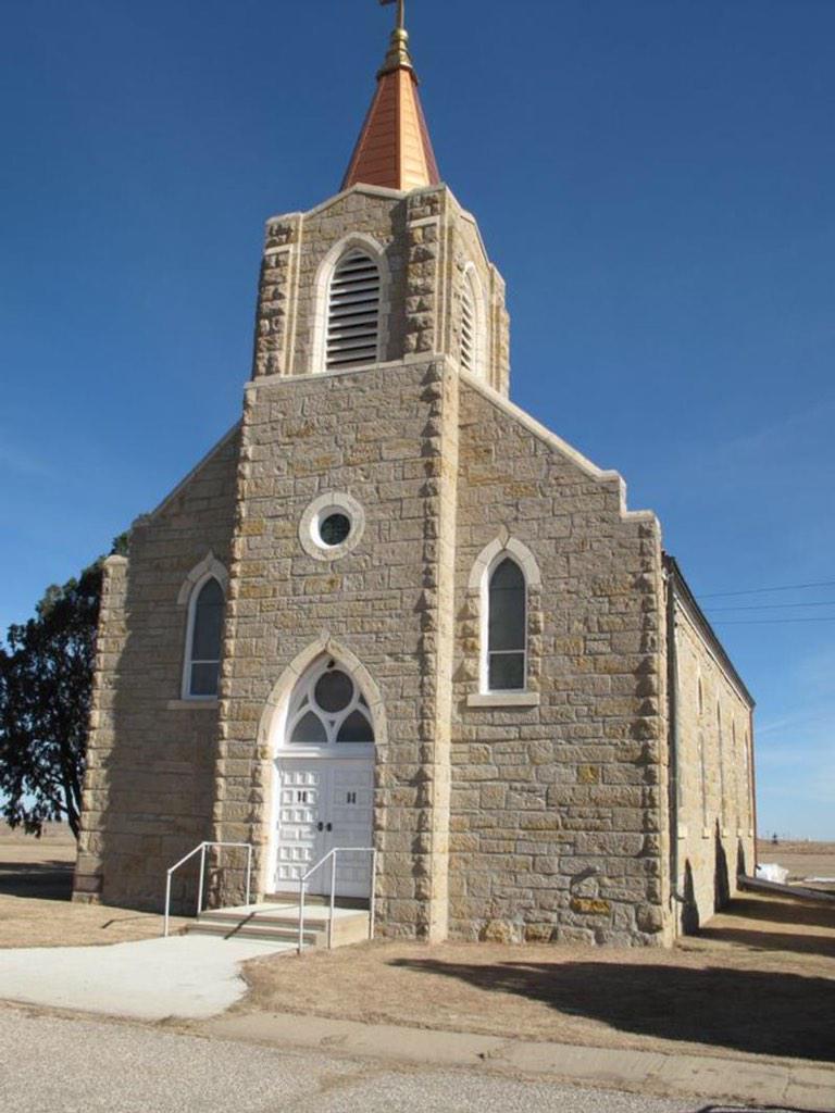
St. Mary's Church was originally constructed in 1904 and was destroyed by fire in 1928. It was determined that it was possible to rebuild the church using the four walls that were still standing. The new church was dedicated in December of that year. The church is a simple Gothic Revival and the land for the church and cemetery was donated by John Gleason who was the first person buried there in 1904 after a team of horses ran over him. The church was started in 1903 after the Irish congregation of St. Joseph's Church had a dispute with the German congregants.

St. Mary's closed in 1997 due to a lack of priests but it remains well-taken care of and the nearby cemetery is still used and owned by the Wichita Archdiocese. The church is owned separately. At the time of its closing, around 30 families were still involved with the church. For more information, go here.


Girl Scout House, Ashland
The Girl Scout Little House was built in 1937 by laborers employed by the WPA. The stone was quarried with native stone from a place north of Ashland and measures 20 by 40 feet. The Ashland Girl Scout Troop was organized in 1924 by Dorothy Berryman. After World War I, efforts were made for the Girl Scouts to build camps and club houses. The Little House movement began in 1923 and aimed to have the Girl Scouts own and maintain their own property. Ashland Girl Scouts worked diligently to obtain the funds to buy and quarry the stone, draft plans and help in the construction. The Little House is currently maintained by the City of Ashland and is still used for meeting space.

For more information, go here.

Strother Field Tetrahedron Wind Indicator, Winfield
In 1941, the city commissioners of Winfield and Arkansas City met to approve a Class 2 airport with one hangar. In 1942, the government was interested in the location as a flight school. The cities leased some land and on November 1, 1942, Strother Army Air Field opened. As World War II came to an end, Strothers Field was put on standby.

Since the airfield didn't have a control tower to assist the pilots, giant tetrahedron wind indicators were installed so that pilots could see which direction the wind was blowing from the air. The tetrahedron were made of thin metal and canvas. The Strother Field wind indicator even retains its original lighting which was used by pilots at night so they could tell the direction. For more information, go here.

It was also decided to add The Last Chance Store in Council Grove to the State Register of Historic Places. It was built in 1857 and was the last stop to buy supplies along the Santa Fe Trail for many years.

Information and photographs courtesy of the Kansas State Historical Society.