Showing posts with label 16th and Mass V2. Show all posts

Friday, June 19, 2015

Kansas School for the Deaf

In 1860, Philip A. Emery arrived in Kansas, in the Wakarusa River valley, to start a new life. He had previously lived in Indiana and worked for their state school for the deaf as a teacher. Thrilled that there was an educator who could teach deaf children, Jonathan Kennedy, who had three deaf children, persuaded Emery to start a school for the deaf. When Emery agreed, Kennedy borrowed $200 and went with Emery to find a suitable location for the school. They found a modest two-room house with an attic in Baldwin City. The rooms could be rented for $5 a month.

The school officially opened October 1861 but didn't receive its first student until December when Elizabeth Studebaker arrived from Clinton. In March 1862, the state legislature voted to assist the school by appropriating $500 per year to help with operational costs and twenty-five cents a day for each student. In 1864, it was decided that all state institutions should be located in Topeka so for a short period, the school was moved to Topeka but returned to Baldwin City the following year. The decision on the location was still up in the air as there became a bidding between Baldwin, Olathe and Topeka over the location for a new school for the deaf.
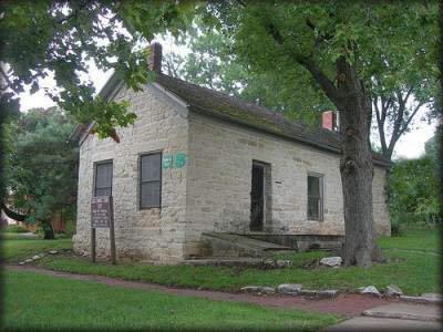
The first School for the Deaf near 10th & Indiana in Baldwin City. Note the wooden
sign typical of historical markers in Baldwin at this time. Via ksdeaf.org
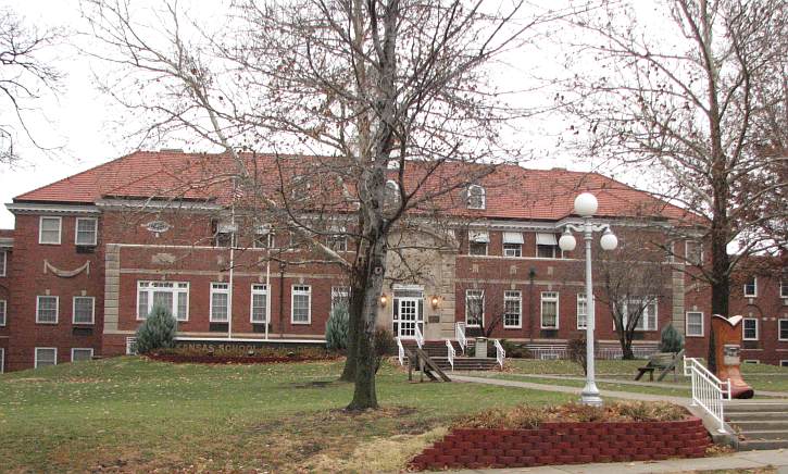
On November 15, 1866, the Kansas State School for the Deaf and its 18 students left Baldwin City for Olathe and into a new stone building. The stone building was torn down in 1886 and replaced with a new administration and dormitory building and by 1893, enrollment at the school was over 200. The current administration and dormitory building was built in 1934.
The current Roth Administration Building. Via kansastravel.com
One of the more prominent pupils, and later teachers, at the school, was Luther Haden "Dummy" Taylor. Taylor was born in Oskaloosa in 1875. While most accounts say that he was born deaf, his family did not list him as such on the 1880 U.S. Census. He was listed, in the 1885 Kansas Census, as being a pupil at the Kansas School for the Deaf in Olathe. He remained at the school through his high school years pitching for the baseball team and boxing. After leaving the school, Taylor played for semi-pro and minor league baseball teams in Missouri, Illinois and Indiana. As of 1900, he was playing for team in Albany, New York.

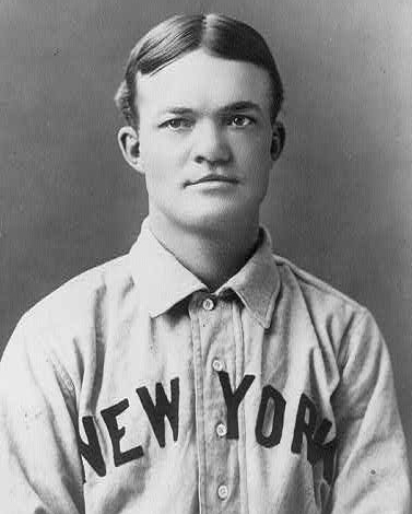
He was called to play with the New York Giants in 1900 and in 1902, went to play for the Cleveland Broncos (later to be the Cleveland Indians) for more money but he was persuading to return to the Giants the next season. In 1903, new manager John McGraw turned the Giants into a formidable team being National League champions in 1904 and 1905. Taylor was sold to the Buffalo Bisons in 1909. Taylor would remain in the minor leagues until his retirement from baseball in 1915.
1903 image of Taylor on the New York Giants. Via Library of Congress.
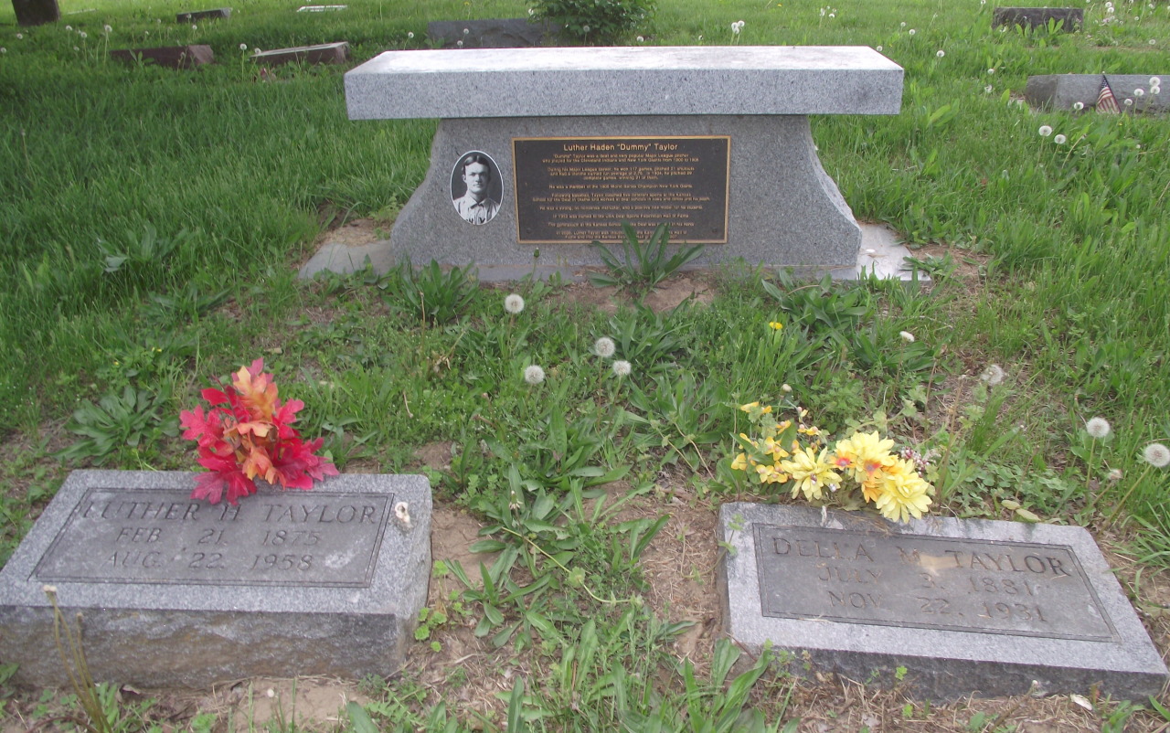
Taylor would return to the Kansas School for the Deaf in 1915 where he would become the physical director and baseball coach. Taylor then moved to the Iowa School for the Deaf in and then the Illinois School for the Deaf. He continued to be very involved with baseball. In August 1958, Luther Taylor passed away at Our Savior's Hospital in Jacksonville, Illinois. He is interred with his first wife, Della, in Prairie City Cemetery in Baldwin City.
Gravestones for Luther and Della Taylor in Prairie City Cemetery. Photo by author.
The Kansas School for the Deaf continues a tradition started by Philip Emery back in 1861 of educating children despite the absence of hearing. Students are encouraged to live up to their full potential and are judged by contributions and character. For more information, please visit ksdeaf.org or the Kansas Deaf Cultural Center located on the Olathe campus.

The site of the original school in Baldwin City is currently a more modern home. The wooden marker, as seen in the above picture, no longer stands. A small stone sits near 10th Street and reads:
School for Deaf 1861-1867

Photo by the author.

Thursday, April 23, 2015

What's In a (Street) Name?


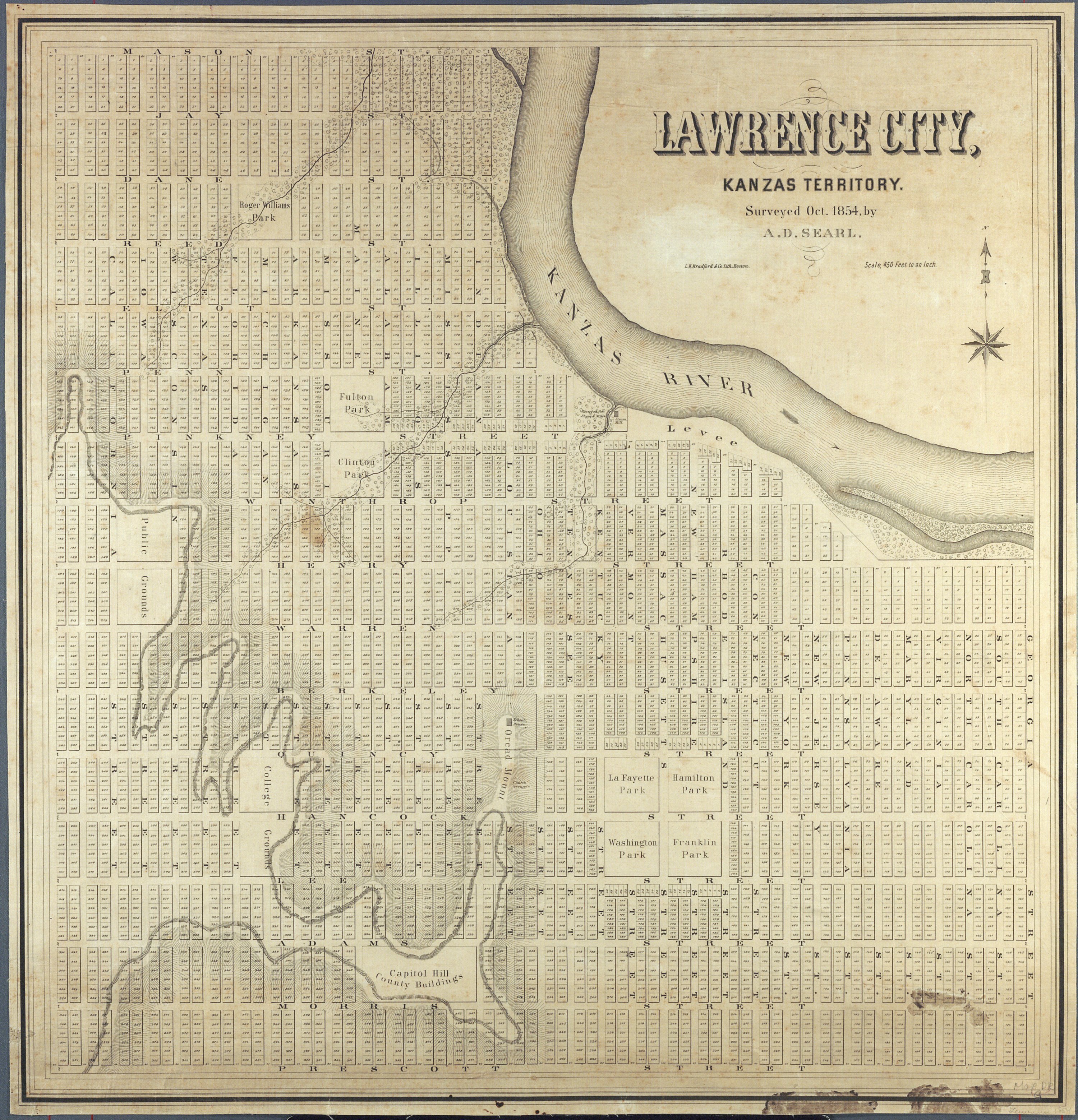
When Lawrence was originally platted, north-south streets were named for the states in the union starting with the order they were admitted in the east. East-west streets were named after Revolutionary War heroes. The state street names begin with Delaware Street about two blocks west of Haskell Avenue. Interestingly, Oregon Street was placed between Delaware and Haskell sometime before 1960, New York (the 11th State) is where Georgia should be and Georgia has never been added to the city. Connecticut and Massachusetts Streets should be right next to each but are instead separated by Rhode Island (13th State) and New Hampshire (9th State) Streets. There is also no North or South Carolina (a Carolina Street does exist near Lawrence High School however, as does Virginia Street) exists.

After passing Massachusetts Streets, the streets follow the order pretty regularly: Vermont, Kentucky, Tennessee, Ohio, Louisiana, Indiana, Mississippi, Illinois, Alabama, Maine, Missouri, Arkansas, Michigan and Florida. Next should be Texas Street but instead it's Minnesota followed by Colorado and Wisconsin and then Iowa Street (the main north-south thoroughfare through Lawrence) ends the state street naming. Lawrence doesn't have streets named after Alaska, Georgia, Hawaii, Idaho, New Mexico, Texas, Washington and Wyoming. And it's been pointed out that if the correct naming had been retained, Kansas Street would be roughly where Iowa Street is, thus making the name a bit more fitting. Instead, Kansas Street is located in the Park Hills Neighborhood off of Louisiana Street.

The east-west streets are now numbered streets after being renamed in 1913. Ironically the numbered streets begin with 2nd Street and not 1st Street. Originally, they were named for Revolutionary War heroes.

Mason Street (should be 1st Street) was probably named for George Mason (1725-1792), one of the Fathers of the Bill of Rights.
An old street sign at 3rd & Indiana in the Pinckney
neighborhood. These old signs are quickly being
replaced with newer ones.

Jay Steet (2nd Street) was probably named for John Jay (1745-1829), influential Founding Father and first Chief Justice of the Supreme Court.

Dane Street (3rd Street) was probably named for Nathan Dane (1752-1835) a Continental Congressman who authorized the Philadelphia Convention to amend the Article of Confederation which later became the United States Constitution.

Reed (4th Street) was probably named for Joseph Reed (1741-1785) who served as a Colonel in the Revolutionary War and later became Secretary of State in New Jersey.

Penn (5th Street) was probably named for John Penn (1741-1788) who signed both the Declaration of Independence and the Articles of Confederation.

5th & Ohio, also in the Pinckney neighborhood.
Pinckney (6th Street, the neighborhood and school) was probably named for Charles Pinckney (1757-1824) who was a governor, Senator and signer of the U.S. Constitution.

Winthrop (7th Street) may have been named after the influential Winthrop family whose members founded the Massachusetts Bay Colony, served as governor of Connecticut and noted Harvard professor.

Henry (8th Street) was probably named after Patrick Henry (1736-1799) a signer of the U.S. Constitution and noted for saying "Give me liberty or give me death."

Warren (9th Street) was probably named for Joseph Warren (1741-1775), a doctor who participated in the Battles of Lexington and Concord and Bunker Hill.

Berkeley (10th Street) may have been named for William Berkeley, a governor from Virginia in the 1600s. I couldn't find any noted Revolutionary War era people named Berkeley.

Quincy (11th Street) was probably named for Josiah Quincy, a Revolutionary War soldier who served alongside George Washington.

Hancock (12th Street) was probably named for John Hancock (1737-1793), signer of the Declaration of Independence.

Lee (13th Street) was probably named for Henry Lee III (1756-1818), who would become a Major General and the father to Confederate General Robert E. Lee.
The street signs in Old West and East Lawrence
note the current name and the historic name.

Adams (14th Street) was probably named for Samuel Adams (1722-1803) a Founding Father who would serve as governor of Massachusetts.

Morris (15th Street) was probably named for Robert Morris (1734-1806), a signer of the Declaration, Articles of Confederation and the Constitution and was considered, after George Washington, the most powerful man in America.

Euclid (16th Street) may have been named for Euclid, Ohio, one of the first cities established outside the original Thirteen Colonies. Euclid was founded in 1796 by a lieutenant in the Revolutionary War, David Dille.

Ontario & Sherman (17th Street) Ontario was named for Fort Ontario in Oswego, New York which was one of several forts built by British to protect the east end of Lake Ontario from the French. Sherman was probably named for Roger Sherman (1721-1793), an early lawyer and politician of our country. He was the only person to sign the Continental Association, the Declaration of Independence, Articles of Confederation and the U.S. Constitution.

Sherman ran from present-day Naismith Drive to Louisiana; Ontario ran from Louisiana to Connecticut.

Rogers & Bews (18th Street) Rogers may have been named for George Rogers Clark (1752-1818), one of the most decorated military officers in the Revolutionary War. I was unable to locate information on the name Bews.

Rogers ran from present-day Naismith Drive to Louisiana; Bews ran from Tennessee to Vermont.

Banks & Leis (19th Street), it's here where the names seem to change from American Revolution honors to Civil War ones. Banks may have been named for Union General Nathaniel Banks (1816-1894) since Banks/19th would've been added after the Civil War. I was unable to verify who Leis might be named for but there was a Civil War solider named John Leis that I found several mentions of.

Senator (20th Street) Clearly I am not going to be able to verify why this street was named Senator. The name could have been chosen to honor Senator James Lane (1814-1866), who moved to Kansas in 1855 and became a staunch abolitionist and Union general, or Senator Stephen Douglas (1816-1861), namesake for the county and prominent politician during the Bleeding Kansas days.

Merchants (21st Street) A common street name, I am unable to determine if this street was named for past businesses that may have been located along this street or to honor someone with the surname Merchants.
22nd & Rhode Island in the Barker
neighborhood.

Carmean & Hosford (22nd Street) I found only minor instances of the names Carmean and Hosford in the Civil War: David Carmean and John Hosford., who you can more about here.

Bishop (23rd Street) I could not find a namesake for what would become the major east-west thoroughfare through Lawrence but found a guy named Richard M. Bishop (1812-1893) who we can all imagine was the namesake. There is a chance that it was named for Reverend William Bishop who presided over the Presbyterian Church from 1858 to 1860.

Not mentioned in this post but Mechanic
Street was probably named for the industrial
businesses centered around it and railroad.
In North Lawrence, east-west streets are your standard city street names, named after trees: Elm, Locust, Walnut, Oak, Hickory, Ash and Maple. There are few street names in honor of people such as Lincoln (Abraham Lincoln, 1809-1865), Lyon (Gen. Nathaniel Lyon, 1818-1861, the first Union general killed in the Civil War), Perry (possibly named for John D. Perry, 1815-1895, president of the Kansas Pacific Railroad that was built through North Lawrence), Lake, may have been named for the lake at Bismarck Grove that was stocked with swans every year for the Bismarck Grove Fair, Funston (Edward Funston, 1836-1911, represented Lawrence in the U.S. Congress from 1884 to 1894 and was the father of Medal of Honor recipient Frederick Funston) and Maiden, I was unable to find an origin for this name which probably differs from the Maiden Lane in New York City which was named for the women who lined the street cleaning their laundry in the now-long-gone creek. Another street, Grant Street, was more than likely named for Grant Township, the township North Lawrence sits in which, in turn, was named for Ulysses S. Grant after being annexed to Douglas County in 1870 from southern Sarcoxie Township in Jefferson County.

The north-south streets are now numbered with North 1st, North 2nd, North 3rd to North 9th Streets but before they were numbered they were given state street names that corresponded with  their southern alignment. North 4th was New York Street, North 5th was Pennsylvania, etc. They were renamed with the southern numbered streets in 1913.

Disclaimer: These are based on my own research and may be inaccurate. I have researched each name and consider this list as correct as possible. If you feel that I have erred somewhere, please let me know via the contact form.

Monday, March 16, 2015

Diversity of Riffle Community Fishes in Pottawatomie Creek, Kansas

Note: The following was written by James Hartman in 1995-96 as his Masters in Biology thesis at Emporia State University. Used with permission.

Pottawatomie Creek is a tributary of the Marais des Cygnes River. [It flows from about ten miles east of the Wolf Creek Nuclear Plant to the Marais des Cygnes just east of Osawatomie.] The study sites include eight riffle sites located on three tributaries and in the main channel. [The] Pottawatomie Creek watershed drains approximately 142, 074 ha (Pottawatomie Creek Watershed Joint District Number 90, 1972, General Plan, Anderson Co., Kansas, 38pp., unpublished) in Coffey, Anderson, Linn, Franklin, and Miami counties, Kansas. The area in which this study was conducted makes up more than half of the drainage of this watershed and was restricted to only Franklin and Anderson counties.
Map of study areas. Locations are approximate. For bigger image, click here.
The eight sampling sites were located in three topographically distinct regions of the Pottawatomie Creek watershed. Two sampling sites (SF1 and SF2) were located on South Fork Pottawatomie Creek (SF). The SF sub-watershed is characterized as predominantly hilly terrain draining woodland, pastureland, and some cropland. [The SF creek flows from about a mile and a half west of Selma to the main branch of Pottawatomie Creek just west of Greeley.] The Cedar Creek (CC) sub-watershed, also had two sampling sites (CC3 and CC4), was represented as somewhat hilly with relatively intermediate topographic relief in comparison with the SF sub-watershed, and drained woodland, pastureland, and a relatively substantial amount of cropland. [Cedar Creek flows from about a mile and a half southeast of Westphalia to the main branch of Pottawatomie Creek three miles north of Garnett. The Cedar Valley Reservoir was built in 1983 just south of Kansas Highway 31.]

Two additional sampling sites (NF5 and NF6) were located on the North Fork Pottawatomie Creek (NF), above the confluences of SF and CC. The NF sub-watershed is characterized as mostly flatland terrain, draining cropland and pastureland. [The North Fork Pottawatomie Creek flows from Osage County until joining with the main branch near the confluence with Cedar Creek.] The last two sampling sites (PC7 and PC8) were located downstream on Pottawatomie Creek (PC) before its confluence with the Marais des Cygne River. The PC sub-watershed is characterized as a broad floodplain containing predominantly cropland, with adjacent hills draining woodland and pastureland. Site PC7 is located between the confluences of CC and SF on the main channel of Pottawatomie Creek, and PC8 is located below the confluence of SF.

[The PC8 sample is located near Lane and is at the site of Dutch Henry's Crossing. In 1856, after hearing about the sack of Lawrence, John Brown selected a party to go on a private expedition. Late in the evening of May 24th, the party--consisting of Brown's sons Frederick, Owen, Salmon and Oliver, Thomas Weiner and James Townsley--called at the house of James P. Doyle and ordered him and his two adult sons, William and Drury to go with them as prisoners. Doyle's 16-year-old son, John, was spared after his mother, Mahalia pleaded for his life. The three men were escorted by their captors out into the darkness, where Owen Brown and one of his brothers killed them with broadswords. John Brown did not participate in the stabbing but fired a shot into the head of the fallen James Doyle to ensure he was dead.

Brown and his band then went to the house of Allen Wilkinson and ordered him out. He was killed by Henry Thompson and Theodore Winer. They then crossed the Pottawatomie and forced their way into the cabin of James Harris. Harris had John S. Wightman, Jerome Glanville, and William Sherman, the brother of Henry "Dutch Henry" Sherman, a militant pro-slavery activist. Glanville and Harris were taken outside and interrogated. Satisfied with their answers, Glanville and Harris were released while Sherman was taken to the creek and hacked to death. It was learned that "Dutch Henry" was the main target during this expedition but he was away. Brown and his party ended the expedition and returned to Osawatomie.]
Dutch Henry's Crossing, near Lane, Franklin County, Kansas.


Monday, February 16, 2015

Historic Sites Board of Review, February 2015

Every quarter, the Kansas State Historical Society holds a review off nominations to the national and state registers of historic places. They post on Twitter what's being nominated, pictures and short histories of the places which is nice because it may be the only way an average Kansan can see some of these places.

Approved for Nomination to the National Register:

Lindquist Building, Lindsborg
The P.J. Lindquist Building was built in 1901 and is located along Main Street in downtown Lindsborg. It was originally constructed to house Lindquist's tailor business on the ground floor. Later, a restaurant and bakery occupied the ground floor. From 1913 until 1922, the building housed the Tea Cup Inn.

Peter J. Lindquist was born in Skoda, Sweden in 1872. He purchased the lot and built this building in 1901 after immigrating to the U.S. in 1892. He married Lindsborg native Anna Swenson in 1895. The Census and Sanborn maps show the Lindquists living in the second-floor apartment possibly due to financial hardships during the Depression.

Although built for Lindquist's tailor business, the commercial space was rented out for most of the Lindquist's ownership of the building. Anna Lindquist sold the building in 1946 six years after her husband died.

The best known business that occupied the Lindquist Building was The Tea Cup Inn, owned and operated by Mary Linderholm who moved to town and opened up the Inn after her husband died in 1912. Her daughters worked as the waitresses. Mary closed the Inn in 1922 due to her daughters growing up and living their own lives. Since then, a variety of businesses have occupied the ground floor until 2006 when the building became vacant. It was purchased by its current owner in 2013. For more information, go here.

Washington School, Independence
Washington School was dedicated in 1940 and was part of a WPA project. The two front entrances have rounded corners and a built-in clock over the south entrance. Washington is a two-story concrete building designed by Thomas Williamson. It served as the Ward One Public School from 1940 until 2011 when it was closed when a new school was built.

The interior features 14 classrooms, two for each grade, a Kindergarten room, art and music room, kitchen, lunch room, and assembly room with a stage. Washington School was built quickly as, since it was a WPA project, ground had to be broken by the end of the year (1938) and completed within one year. In 1991, Washington became the school that housed the fifth graders until 2011 when Jefferson Elementary School was built to house 3rd-5th graders. Washington's sister school, built at the same time, Lincoln Elementary was sold to the hospital and demolished while Washington was recently sold and will be converted into apartments. For more information, go here.

Bown-Corby School, Marion
This beautiful Collegiate Gothic building was built in 1929 to replace another school that was on this site. It was named after Anna Bown and Jenny Corby, two longtime school teachers in the Marion school district. Corby would be the principal of Bown-Corby School from its opening until she retired in 1941.

Bown-Corby held classes for grades Kindergarten through 8th until 1961 when a new modern elementary school was built. Bown-Corby then held Kindergarten through 3rd grade until 1992 when it became the Marion County Community College until 2012. It was recently purchased by a developer who plans to renovate it into apartments. For more information, go here.

Hermit Cave and Belfry Hill, Council Grove

Belfry Hill is a natural rise of about 70-100 feet near the center of Council Grove. Early photos shows a bare mound with no trees or vegetation. By the 20th Century, the hill was covered with mature trees creating a beautiful backdrop to downtown Council Grove. Terracing was placed around the hill in 1901 in an effort to clean up the hill. Since then, the area has been a popular tourist attraction.

Hermit's Cave is located on the eastern bluff of Belfry Hill. A stone staircase leads from Belfry Street to the cave. For five months in 1863, Father Giovanni de Agostini (Father Francesco) stayed in the cave while traveling the Santa Fe Trail. He became known as the Hermit Priest thus giving the cave its name.

Another feature of Belfry Hill is the Old Bell Monument. Nearly nine feet tall, a limestone obelisk hold the remains of a bell placed there in 1863 that was used to warn the townspeople of Indian raids, however, this is inaccurate. The bell broke in 1884 but was rescued and attached to this stone monument in 1901 after a group of schoolchildren raised money and stone for the memorial. Initials of the schoolchildren are carved into the stone. The bell was purchased from the Plymouth Congregational Church in Lawrence in 1863 after it was rejected for having a crack. The bell was used until 1884, even tolling all day when President James Garfield died in 1881, when a wind storm destroyed the bell tower and the bell rolled down the hill and was further damaged by vandals. The bell was used as a flower pot until 1901 when the monument was constructed.

For more information, go here.

Fix Farmstead, Alma
John Robert Fix came to Kansas Territory with his parents in 1856. Upon heading westward from Leavenworth, the hills along Mill Creek reminded them of the hills in Pennsylvania so they decided to preempt a claim along the West Branch of Mill Creek in western Wabaunsee County. Fix enlisted in the army during the Civil War and witnessed the engagement of the Monitor and the Merrimac, the Battle of Gettysburg and the Seven Days Fight. After the war, Fix went to Indiana where he married Rebecca Larch. They returned to Kansas in 1866.

John built a sturdy stone house shortly after arriving on land just west of his parents original claim. In 1886, the Fixes sold a strip of land to the Chicago, Rock Island and Pacific Railroad. After the railroad was built a town, Volland, was established nearby. John Fix died in 1918, Rebecca following in 1922. The farmstead stayed in the family until 1955 when it was sold. John Fix, along with his wife, daughter, parents and close friends are buried near the farmstead in the Fix Cemetery along the railroad.

For more information, go here.

The Parsonian Building, Parsons
In 1954, the Parsonian Hotel opened with great fanfare. It was decided in 1951 that Parsons needed a modern hotel. The city had been trying to get new accommodations for years but the plans always fell through for one reason or another. The Parsonian demonstrates the Modern Movement Style of architecture that was common during this time and signified Parsons progressiveness. In total, the hotel is eight stories tall, red brick is used on the bottom two stories while yellow brick is used on floors 3 through 8. Sadly, eight years later, stockholders voted to sell the hotel in order to avoid foreclosure. It was then reopened as a hotel and convention center by Mr. and Mrs. Joe Bartelli but the hotel still struggled but remained a hotel and in the Bartelli family until 2008 when it was purchased by a developer to become apartments. The top two floors were completely renovated when the money ran out. The Parsonian currently sits vacant.

For more information, go here.

Route 66 Historic District, Baxter Springs
Historic Route 66 briefly enters Kansas in the southeast. It only goes 13 miles but all 13 miles of it can still be driven on and is well-marked. Route 66 came into existence in 1926 and connected Chicago to Los Angeles. 66 served the area until Interstate 44 became the primary transportation route. 66 was decommissioned in 1985.

The nominated portion spans 2.1 miles from just south of the Brush Creek Rainbow Arch Bridge (1923, on the NRHP) to the Willow Creek Bridge. For more information, go here.

St. Mary's Church, Kinsley
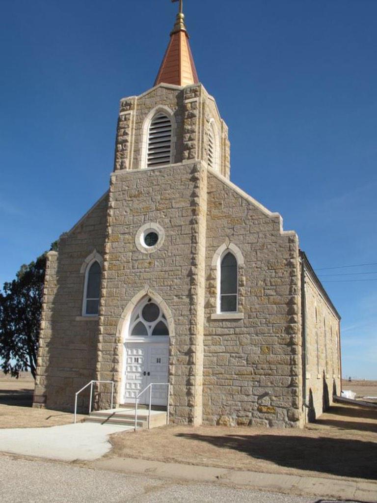
St. Mary's Church was originally constructed in 1904 and was destroyed by fire in 1928. It was determined that it was possible to rebuild the church using the four walls that were still standing. The new church was dedicated in December of that year. The church is a simple Gothic Revival and the land for the church and cemetery was donated by John Gleason who was the first person buried there in 1904 after a team of horses ran over him. The church was started in 1903 after the Irish congregation of St. Joseph's Church had a dispute with the German congregants.

St. Mary's closed in 1997 due to a lack of priests but it remains well-taken care of and the nearby cemetery is still used and owned by the Wichita Archdiocese. The church is owned separately. At the time of its closing, around 30 families were still involved with the church. For more information, go here.


Girl Scout House, Ashland
The Girl Scout Little House was built in 1937 by laborers employed by the WPA. The stone was quarried with native stone from a place north of Ashland and measures 20 by 40 feet. The Ashland Girl Scout Troop was organized in 1924 by Dorothy Berryman. After World War I, efforts were made for the Girl Scouts to build camps and club houses. The Little House movement began in 1923 and aimed to have the Girl Scouts own and maintain their own property. Ashland Girl Scouts worked diligently to obtain the funds to buy and quarry the stone, draft plans and help in the construction. The Little House is currently maintained by the City of Ashland and is still used for meeting space.

For more information, go here.

Strother Field Tetrahedron Wind Indicator, Winfield
In 1941, the city commissioners of Winfield and Arkansas City met to approve a Class 2 airport with one hangar. In 1942, the government was interested in the location as a flight school. The cities leased some land and on November 1, 1942, Strother Army Air Field opened. As World War II came to an end, Strothers Field was put on standby.

Since the airfield didn't have a control tower to assist the pilots, giant tetrahedron wind indicators were installed so that pilots could see which direction the wind was blowing from the air. The tetrahedron were made of thin metal and canvas. The Strother Field wind indicator even retains its original lighting which was used by pilots at night so they could tell the direction. For more information, go here.

It was also decided to add The Last Chance Store in Council Grove to the State Register of Historic Places. It was built in 1857 and was the last stop to buy supplies along the Santa Fe Trail for many years.

Information and photographs courtesy of the Kansas State Historical Society.

Friday, January 30, 2015

The Seals of Kansas


The Seal of the Territory of Kansas
The seal of the Territory of Kansas features a pioneer holding a rifle standing with Ceres, the Goddess of Agriculture, with a sheaf of grain, and a shield with a plow in the top part and a hunter and a buffalo in the bottom part. At the feet of the pioneer and Ceres is a tree and the ax that felled it.

Above the image is, in Latin, POPULI VOCENATA, which means "Born by the voice of the people."

The original draft of the seal of the State of Kansas was much more simple than the one eventually chosen. The seal shows a farmer and a businessman holding a book over a shield that features and image of a Native American hunting a buffalo. Above the men features the state motto "Ad Astra Per Aspera" and 34 stars.

The seal we all know and love that is used on the state flag. The rising sun represents the east, commerce is represented by the river and steamboat, agriculture and future prosperity of the state is represented by the settler's cabin and the man plowing the field. The train of oxen represents heading west while in the background, a herd of buffalo are pursued by two Native Americans.

Above the scene is the state motto and 34 stars.

Photos courtesy:
Kansas State Historical Society
KansasMemory.org

Wednesday, December 17, 2014

Rev. John E. Stewart


In a continuation of the post last week, another member of The Immortal Ten helped on the Underground Railroad and lived about a mile east of Kennedy Valley.

Reverend John E. Stewart was born in England in 1818 and was a minister in New Salem, New Hampshire before coming to Kansas. Stewart's claim with a few miles southeast of Lawrence along the Wakarusa River. It was near what is now North 1175 Road and East 1600 Road but the exact location of where the house was is unknown.

Stewart operated a branch of the Underground Railroad on his land and helped roughly 70 slaves to freedom from Missouri. Stewart also was a close friend of Charley Hart--better known as William Quantrill. When Stewart found out that Hart was hunting down freed slaves and sending them back to Missouri, Stewart broke off all ties and helped get Hart run out of Lawrence. Hart would return to Lawrence with about 300 additional men during the morning of August 21, 1863.

A couple of portrayals paint Stewart in a different light where he had no regard for property or life and was more than happy using terror and threats to further the abolitionist cause. Stewart married Mary Ann in the late 1850s and remarried to Jenny Blackmar in 1870 and Sarah Hufford after that. He moved to Ohio in 1870 and is buried in Perrysburg.

Sources
John Stewart and Others of the Wakarusa/Kennedy Valley by The Wakarusa Valley Heritage Museum

~*~*~

If you have a story or history that you would like to submit or have me try and research, please let me know using the Contact form. For submissions, please make sure there are sources cited.

Wednesday, December 10, 2014

Silas Soule and Sand Creek


In 1851, the Treaty of Fort Laramie recognized that the Cheyenne and Arapaho held territory encompassing land between the North Platte River and Arkansas River from the Rocky Mountains to western Kansas. By 1859, gold was discovered in the Rockies bringing a gold rush to what was then western Kansas Territory. The Cheyenne and Arapaho urged federal authorities to redefine what their lands were and in the fall of 1860, a new treaty was negotiated.

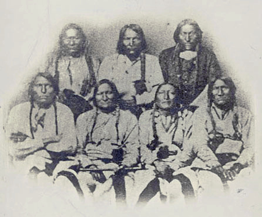
The delegation of Kiowa, Cheyenne and
Arapaho chiefs, September 1864. Black
Kettle is 2nd from left, front row.
Photo: Smithsonian Institute.
The Treaty of Fort Wise was signed February of 1861. The new reserve was less than 1/13th the size of the 1851 reserve. Some bands were angry at the chiefs who signed the treaty feeling that the treaty was signed by a minority and didn't fully represent the rest of the tribe and refused to abide by the treaty. Black Kettle, leading chief of a band of around 800 mostly Southern Cheyenne, led his band to Fort Lyon in accordance with provisions of a peace parley held in Denver in September 1864. Bands not abiding by the 1861 treaty were not a part of Black Kettle's tribe nor a part of the Arapaho who joined Black Kettle in November. Black Kettle flew an American flag and a white flag as ordered by the commander of nearby Fort Lyon suggested to show he was friendly and was assured of protection.

Col. John Chivington
Meanwhile, Colonel John Chivington and his 700 soldiers went to Fort Lyon and then set out for Black Kettle's camp. The evening of November 28, 1964, the soldiers and militia drank heavily and celebrated their anticipated victory. Disregarding the American and white flag, Chivington and his men attacked. Numbers vary about how many Indians were killed ranging from as high as 600 to 20. Chivington and his men scalped many of the dead including the women and children and dressed their weapons, hats and other gear with scalps, human fetuses and genitalia.

Silas Soule, circa 1864-65.
Photo: Denver Public Library
Silas Soule was born in 1838 in Bath, Maine and, in 1854, joined his family with the New England Emigrant Aid Company in settling the Kansas Territory. The Soule family was one of founding families of Lawrence. Silas' mother and two sisters arrived in Kansas the following summer and the Soules moved to the Coal Creek area of Douglas County near present day Vinland. The Soule house was a stop on the Underground Railroad and Silas, at the age of 17, was helping escort slaves who had escaped from Missouri.

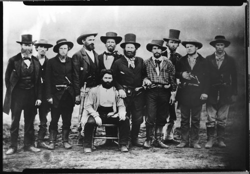
In July 1859, 20 pro-slavery men crossed into Kansas and ambushed a party led by Dr. John Doy who was escorting 13 former slaves to Iowa. The men from Missouri arrested Doy, tried and convicted him sentencing him to five years in prison. Soule and a group of other men decided to free Doy, overpowered the jailer, freeing Doy and leading him across the border back to Kansas. When they got back to Lawrence, their photo was taken. The photo, called The Immortal Ten, is widely circulated and a Kansas icon. Soule was also tasked with freeing John Brown after he was captured after his raid on Harper's Ferry. Brown allowed himself to be hanged hoping his death would start a war. Soule then tried to free two of Brown's men who refused to come with him.
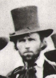
The John Doy rescue party "The Immortal Ten." Doy is seated. Soule is 2nd
from the right. Photo: Amon Gilbert DeLee, courtesy Kansas State Historical Society.
During the Colorado gold rush in 1860, Soule, along with his brother and cousin, went out west where he dug for gold and worked in a blacksmith shop. In 1861, after the start of the Civil War, Soule enlisted in Company K, 1st Colorado Infantry and took part in the victorious New Mexico Campaign of 1862. In November 1864, he was assigned the command of Company D. On November 29, Soule and his men were with Colonel Chivington at Sand Creek when he ordered the cavalry to attack the Cheyenne and Arapaho camp. Seeing that the camp was flying an American and white flag, Soule, and Lt. Joseph Cramer, ordered their men to hold their fire.

The Army investigated what would become the Sand Creek Massacre and Soule testified against Chivington in court in January 1865. Soule was married to Hersa Coberly in March of 1865 and was on duty as a Provost Marshal in Denver on April 23, 1865 when shots rang out. One of the bullets hit Soule in the head, killing him almost instantly. It is believed that someone who was a supporter of Chivington did the killing or ordered it. The murderer was never brought to justice. Soule was buried in Denver's historic Riverside Cemetery and is remembered every year during remembrance ceremonies of the Sand Creek Massacre where the graves of Soule and Cramer are decorated. A plaque commemorating Soule was also placed on a building at 15th and Arapaho in Denver.
Soule's gravestone in Riverside Cemetery
in Denver, Colorado. Courtesy FindAGrave.


Saturday, November 22, 2014

The Douglas County Poor Farm


The poor house was a social institution that dates back to 1697 when the first English workhouse opened in Bristol, England. The poor house came along due to parameters set by Queen Elizabeth I in 1601 which called for taxes to be collected and the creation of almshouses for the aged, infirmed, mothers of illegitimate children and children incapable of work. It was important legislation because it established state responsibility for the poor and began a standard by which care should be delivered.

The English law followed colonists to America and the first public almshouse in America was started in Philadelphia in 1731. All residents—lame, sick, vagrants, aged, children, unmarried mothers, blind and able-bodied poor—were housed together and worked for their keep. In Midwestern states, the almshouses were typically called “poor farms” and it was run as exactly that. Male residents tended animals and crops and performed routine maintenance. Women took care of the house and household chores.

The first poor farms in Kansas were started in Leavenworth and Douglas Counties in 1866. By 1899, eighty of the 105 counties had poor farms. The poor farm in Douglas County was first organized in 1866 when the county commission minutes showed of purchase of a 160-acre farm from George Sterns for $2,200.

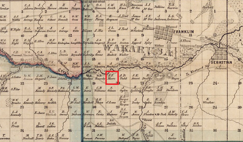
The 160 acres was located one and one quarter mile south of 31st Street and Haskell Avenue on the south side of the Wakarusa River. The legal boundaries of the property were the northwest quarter of Township 13, Range 20 and Section 20 and according to a 1857 map of Douglas County, the property was owned by R.P. Moore at some point the property came under the ownership of George Sterns.
image
1857 Plat map of Douglas County. R.P. Moore land highlighted.
The county purchased the land January 30, 1866 and four days later plans for a farmhouse “two stories high, 24 feet wide by 36 feet long to be built on the county farm and used for a county asylum for the poor” were noted. The farmhouse cost $3,760. No pictures of this farmhouse exist but at the time, the poor farm houses looked like your typical farmhouses from that period. In March, a superintendent was hired for the cost of $1,200 a year for himself and his family.

Census records from 1870 list twelve residents of the farm. Two males were listed as “farm laborers” and a woman was “keeping house.” Six ‘paupers,’ ranging from 2-year-old Willy to an 80-year-old man, were listed as illiterate, and one was designated an ‘idiot.’ People on the farm worked if they were able to. They maintained the house, tended crops, fed livestock—which mainly consisted from cows, pigs and chickens—and women usually did house work including cooking, cleaning and laundry.

In 1887, the Poor Farm’s superintendent was a Mr. Dodge who was described by some as a “common drunkard” and “a profane and brutal man.” When an aged Irishman died at the farm and was buried unceremoniously in the farm cemetery on the bank of the Wakarusa River, George Hollingberry expressed his unhappiness with the neglect and mistreatment of the county home to the Lawrence Daily Journal and county commissioners. While several people testified that Mr. Dodge was a good farmer, they still felt he should be removed as superintendent of “The Home.”
image
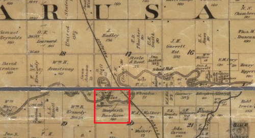
1887 Plat map showing the Poor Farm property in red. The main road to the Farm veers to the southeast before
crossing the Wakarusa River over an iron bridge.
In the early 1900s, Daniel F. Heaston was the superintendent of the Poor Farm. The Heastons originally owned a farm two and a half miles south of Pleasant Grove. They were a very religious family and held devotionals every evening before retiring to bed. The Heastons remained the farm superintendents until shortly after the new building was opened when they moved to Lawrence and operated a broom shop.

A list of names recorded by the poor farm and submitted to the Douglas County commission shows that the poor farm assisted 109 people between 1909 and 1910 and this was in addition to the people whose residence was at the farm. Most of the patrons were from Lawrence but Lecompton, Eudora and Baldwin City were represented as were Lone Star, Lecompton Township and Vinland.

One of the more interesting names on the list is a Mrs. Mary Henderson who doesn’t have an address listed next to her but “Cocain Mary.” From what I found in newspaper archives, “Cocaine Mary” was an interesting character in Lawrence. Mentions of her in the various newspapers report her many arrests due to drugs and drunkenness. In 1910, she was shot at a party in Bloomington but it was unclear whether someone shot her or she shot herself. After accosting people heading to the Santa Fe Depot at 7th and New Jersey Streets, Mary was arrested and put on trial to determine if she should be remanded to the custody of the county. She was declared unfit to care for herself but, having no relatives and being unable to find anyone to take up the burden, she was released back into society. She is listed as being arrested again with a “Mexican friend whose name can’t be written” for indecent conduct. After that incident, news on “Cocaine Mary” ceased.

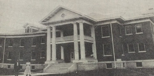
Deciding that it was time to expand the poor farm, county commissioners accepted the construction bid from John H. Petty of $22,944.00 to construct a two-story, brick structure with large pillars in front. Commissioners formally accepted the building on March 13, 1911 finding it “according to contract in every respect.” The old frame house was torn down.
image
1911 Douglas County Poor Farm
The early 1910s was a good time for Lawrence. The city had more paved streets than any other Kansas city and the new building exceeded the expectations of a poor farm. Residents seemed to enjoy living there and it was the county commission that made the farm pay for itself. “I can remember it very distinctly,” County Commissioner Bob Neis said. “When I was a kid we used to go out there and buy some seeds or cows or pigs.” But Neis also noted that “it was a black eye in somebody’s life to end up at the poor farm.”

On March 15, 1927, a barn was destroyed by fire. W.J. Welshimer had been dismissed from the farm earlier that day and was later convicted of arson in the fourth degree. When he appeared for sentence at the jail, he stated “you wouldn’t keep me at the County Home, so I had to fix it so you would keep me some place.”

Aside from the occasional news report, life at the poor farm was quiet and peaceful. The farm provided most of its own food and raised livestock but tragedy struck in the early morning hours of April 11, 1944.

Superintendent George Hoskinson was awakened by the screams of two elderly men in the basement. George rushed to fight the flames while his wife went to a nearby farm to call the fire department. By the time the fire department arrived, flames had already engulfed the building. Hoskinson and six other employees were able to rescue the 26 residents. Eight residents burned to death in the fire. Mr. Hoskinson said that he helped one inmate out twice but she returned to the building and died in the flames. Another man, 69-years-old, was taken to Lawrence Memorial Hospital with both legs fractured having either fell or jumped from a second story window.

The fire could clearly be seen from Lawrence and later that day, Coronor C.B. Ramsey assembled a jury to visit the ruins of the home to gather evidence and to remove the remains of the deceased. With the help of the Red Cross, inmates were cared for at the Community Building at 11th & Vermont Streets until arrangements could be made for their care. Fire Chief Paul Ingels surmised that the fire started in a fusebox. County Commissioners also announced the next day that a small farmhouse would be built southwest of the poor farm ruins using salvageable material from the gutted building. The county sold the livestock and equipment and finally the land in 1946.
image
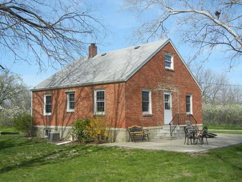
The farmhouse built from the ruins of the Douglas County Poor Farm, circa 2013. Photo by Dale Nimz.
World War II affected the commissioners decision to abandon the poor farm but still wanting and needing to care for the elderly, the county quickly bought a house at 1004 West 4th Street to be used as a convalescent hospital.

Lucius H. Perkins was born in Racine County, Wisconsin on March 5, 1855. His parents, natives of Onondaga County, New York, were among the pioneers of southeastern Wisconsin. Perkins ancestry appeared as early as the tenth century and possessed large estates surrounding Ufton Court in Berkshire. The first Perkins to come to America was John W. who arrived in 1631 aboard the Lion and became a member of the Massachusetts Bay Colony at Ipswich. He later moved to Norwich, Connecticut where they remained for nearly 200 years when they moved to New York.

In 1877, Lucius graduated from Beloit College and moved to Lawrence where he became a student of law in the office of Judge Solon O. Thacher. After two years, he became a member of the first graduating class of the University of Kansas School of Law. He was one of the first to be appointed on the State Board of Law Examiners and retained that position until his death.

On May 15, 1882, Mr. Perkins married Clara Morris. They had four children, Bertram (1883-1887), Clement (1885-1966), Rollin (1889-1993) and Lucius J. (1897-2003). Mr. Perkins was fond of travel, devotedly attached to his home, loved the companionship of his fellow men and opened his home, a stately house he named Ufton Court, after his ancestral home in Berkshire, designed by John G. Haskell, 25 rooms, three-stories with a red tile roof and decorative tower, for all the neighboring boys. Mr. Perkins died suddenly at his home on June 1, 1907 from a fall at his house.
1907 Lawrence Daily Journal photograph of Ufton Court the day after Perkins died.

After Perkins’ death, the house was sold to the Alpha Tau Omega fraternity. During World War II, the house was renamed Victory Mansion and was a home for employees of the Sunflower Ordinance Plant in DeSoto. The county bought the house the day after the fire and in September of that year, the Douglas County Convalescent Hospital opened with 31 beds. Through the years numerous additions would be added on but the building had problems.

“It wasn’t what you would call a safe place for old people,” Douglas County Commissioner Walter Kampschroder remembered. “[T]he state health department got to checking and […] they were putting quite a bit of heat on us,” he said. On November 4, 1958, voters narrowly approved the construction of a new county nursing home. Two years later, voters approved the sale of the old home which was purchased by the Medical Arts Center and razed in 1962 for a parking lot.

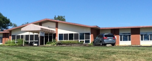
The Valleyview Care Home opened in April 1961 at 2518 Ridge Court with 51 beds. The county leased the home to private operators and paid a monthly fee for all county partners. In 1975, commissioners were urged to return as the operators of the home since “maintaining […] profit was the prime concern of […] private operators.” The county took charge of the home the remainder of the time it was open.
image
The United Way Building, formerly the Valleyview Care Home, in 2014.
In 1992, the Valley View board of trustees voted to turn over management to Retirement Management, Inc. when Valley View became too much of a financial drain for the county. RMI then decided to build a new facility to replace Valley View near its Brandon Woods facility near 15th Street and Wakarusa Drive. Valley View officially closed its doors September 1, 1995 effectively ending the 129-year history of the Douglas County Poor Farm.

In 1996, the United Way of Douglas County purchased the building to use as their offices along with the offices of numerous other charities such as the Red Cross, Girl Scouts, Big Brothers Big Sisters and Tenant to Homeowner. The Poor Farm is marked today by the farmhouse built in 1944, a barn and silo on the south side of North 1175 Road, a chicken coop and root cellar.

The Poor Farm Cemetery and Deaths

The Douglas County Poor Farm Cemetery was “situated on the banks of the Wakarusa River in a narrow strip of land between the river and the road”, was supposedly unmarked and used throughout the years as a cow pasture where the land was desecrated by rooting pigs and the tramp of horses and cows. The exact location of the cemetery is unknown and it’s suggested that it no longer exists due to the change in the Wakarusa River’s channel.

The only cemetery records for the poor farm exist in mortuary records from C.W. Smith. It shows only the burials that C.W. Smith Mortuary handled for the poor farm. Known burials in the Poor Farm Cemetery are:
  • Joseph Franklin, buried Dec. 16, 1893, aged 64
  • Infant Furgason, buried Jan. 4, 1891, no age given
  • Child Hattan, buried Apr. 28, 1893, no age given
  • Infant Edwards, buried Nov. 25, 1901, stillborn
  • Minnie Anderson, buried Jan. 19, 1894, no age given
  • Daniel Barkley, buried Jan. 23, 1895, no age given
  • Mrs. Lowe, buried Oct. 21, 1891, no age given
  • Carrie Low(s), buried January 1893
  • Unknown Sukey, buried Feb. 11, 1891
  • Unknown Jackson, buried July 3, 1892
  • Child of Carder, buried Apr. 22, 1893
  • Ora Wright, buried May 10, 1892
Eight people died in the Poor Farm fire of April 13, 1944. Listed are those who died in the fire, their age, residence and location of burial:
  • Mrs. Albert Bebout, 86, Lawrence, buried in Oak Hill Cemetery, Lawrence
  • Mrs. Ida Clark, 80, Lecompton, buried in Maple Grove Cemetery, Lecompton
  • Miss Elizabeth Whitelaw, 76, Topeka, buried in Oak Hill Cemetery, Lawrence
  • Peter Luzius, 83, Lawrence, buried in Oak Hill Cemetery, Lawrence
  • Fred W. Plateman, 88, Big Springs,
  • William St. Clair, 88, Big Springs, Maple Grove Cemetery, Lecompton
  • Isaac Tabor, 71, Lawrence,
  • Lafayette Tabor, 82, Lawrence, buried in Beulah Cemetery, Colby
Sources
The Complete Tombstone Census of Douglas County, Kansas Volume 2 by Jean Snedeger, Douglas County Genealogical Society, 1988.
Douglas County Poor Farm files, Watkins Museum of History, Lawrence, Kansas, accessed 2014.
The Jeffersonian Gazette, April 6, 1910
The Lawrence Daily Journal, January 23, 1887
----- January 28, 1888
-----June 3, 1907
Lawrence Daily Journal-World, July 27, 1915
Lawrence Daily World, November 23, 1909
-----February 7, 1910
Lawrence Journal-World, April 13, 1944
-----April 14, 1944
-----October 18, 1981
Standard History of Kansas and Kansans by William E. Connelley, 1918.

Originally published on The Point of Beginning on November 17, 2014.